Capturing the life history of your vineyard, one vine at a time.
Sentinel creates and maintains a permanent vine record for every vine in your vineyard—tracking any parameter you define: disease history, production status, vigor, cluster counts, photos, operations, and more. Query, analyze, chart, and report on that data today, next vintage, and for the full life of your vineyard.
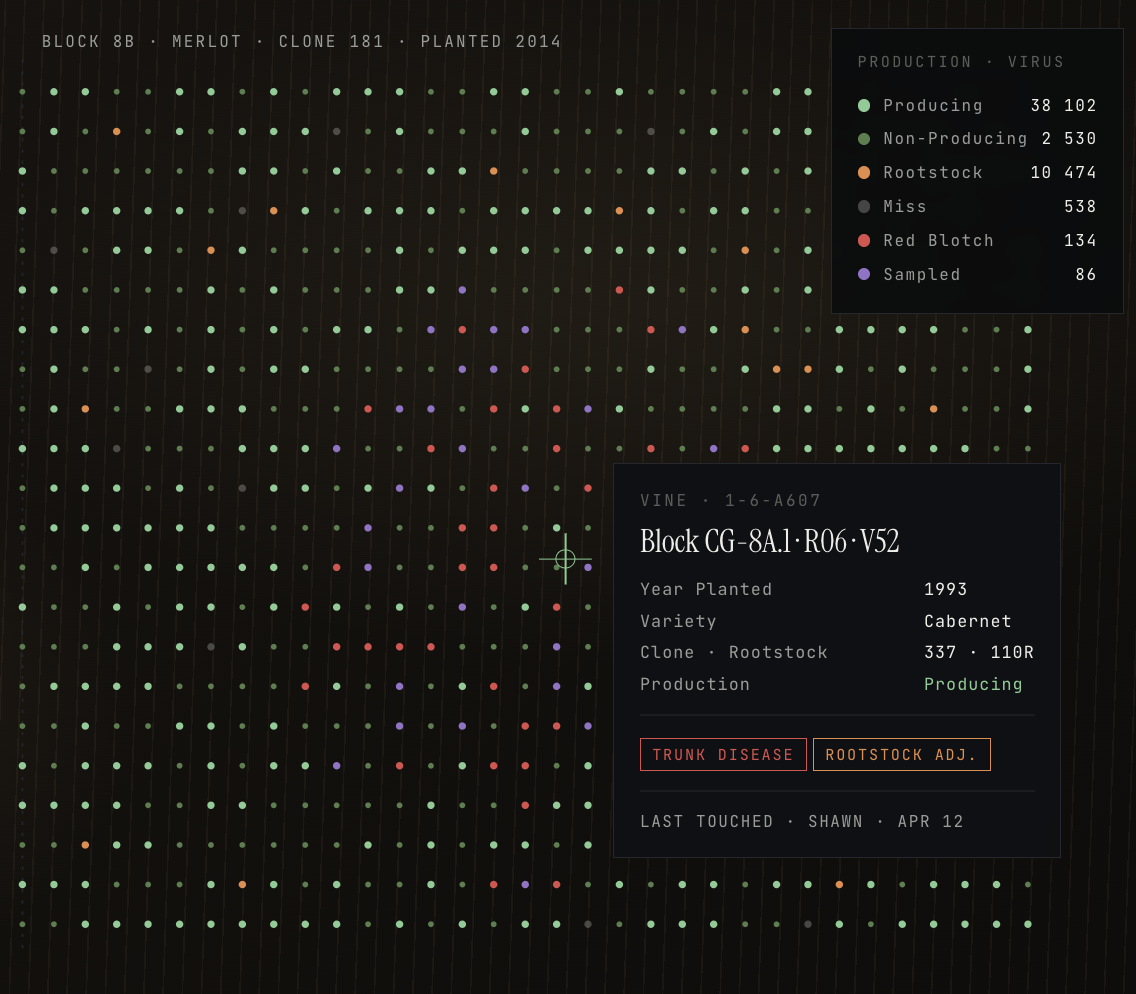
Not just a dot map. A permanent record for every vine in your vineyard.
Vine By Vine™
Map hectares of vineyard in minutes with sub-centimeter accuracy. Each vine becomes a permanent, user-verified record—no double entry, no re-mapping next season.
MappingMOD . 002Maturity Monitoring
Vineyards develop greater heterogeneity as they age. Sentinel lets you identify underperforming vines early, quantify the problem, and follow up at the individual vine.
PhenologyMOD . 003Pest & Disease Tracking
Tag suspected vines, auto-generate lab sample labels, bulk-upload results, and auto-update disease status. Our goal: the medical record-keeping system for the world's great vineyards.
TriageMOD . 004Historical Analysis & Work Orders
Construct complex queries across vine age, production, and disease status. Operationalize roguing, grafting, planting and harvest—with statuses that update on completion.
AnalyticsNEWMOD . 005Pesticide Use Reporting
Log a spray in Sentinel and the system generates a compliant XML report—permit number, site coordinates, product, acreage. Submit to county and state directly. No separate tool, no re-entry.
ComplianceNEWMOD . 006Cellar Management
Track lots from harvest to bottle—fermentation, Brix/pH/TA/SO2/VA, vessel assignments, barrel inventory. Every lot ties back to the block and vines it came from. Bundled in your subscription.
Vine-to-bottleNDVI tells you where. Sentinel tells you why.
Exhibit A . Automated Vineyard Imaging
More data isn't better data.
Cameras and proprietary models can generate terabytes of imagery—but the models are black boxes, the outputs need hand-validation, and the response they're prescribing may not match the scale of problem you actually want to tackle. Sentinel puts that control back in the hands of the people who know the vineyard.
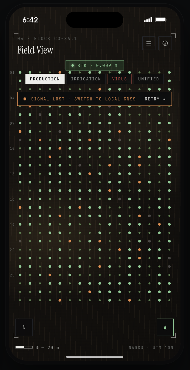
Exhibit B . Sentinel
Ground-truthed, vine by vine.
Mapped once with sub-centimeter GNSS accuracy. Updated continuously with disease status, production history, photos, lab results, and every management decision made in the field. Ground truth that lives as long as your vineyard does.
Georeferenced. Interactive. On every phone in your vineyard.
Map in 3D
One pass. Sub-centimeter accuracy. A permanent 3D base map of every vine in your vineyard—built with nothing more than an iPhone and a pocket size GNSS receiver.
Build the vine record
Walk up to any vine and its record opens automatically via geofence. Attach disease status, production status, cluster counts, captioned photos—no Excel, no clipboards.
Issue work orders
Create targeted tasks: rogue all Red-Blotch-positive vines, plant a list of misses, graft a cohort. Vine statuses auto-update as work is completed in the field.
Compare vintages
Time-series analysis at the vine, block and vineyard level. Did the virus spread? Is production declining? Budget conversations come with a map, not a guess.
Flagging tape and Excel maps work until they don't. As the scale of the problem grew, so did the burden of managing it. With Sentinel, the entire workflow—tagging, testing, reporting, roguing—lives in one system that remembers every vine and every action.
Second-vintage deployment